I'm no stranger to birder directions, they can be hard to follow. I think many of us rejoiced with personal navigators in the hopes that it would make finding parks chock full of birds much easier. Google maps has been around for a few years and has plenty of time to get the kinks worked out, right? Nope.
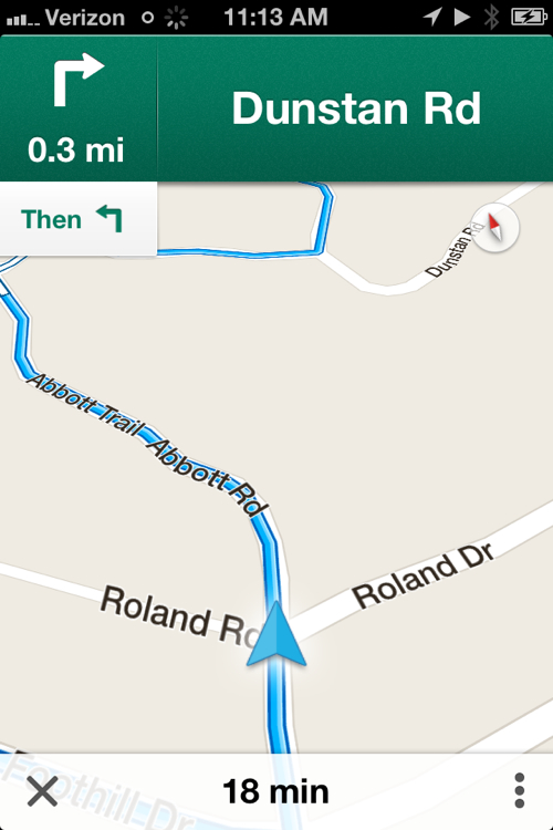
I don't rely on only my navigator, I usually double check a map or two before I head out. Here's a great example why as I tried to get to a mountain retreat in Lucerne, California this past weekend. Here is how the Google Maps app on my iPhone told me to get to Precious Forest:
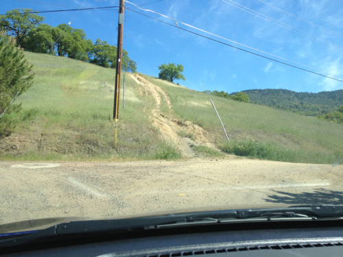
Here's what the reality of what Abbott Rd intersected with Roland Dr actually looked like:
That's not even a minimum maintenance road, that's a two track!
I had this happen too when I was in the Rio Grande Valley too. I would type in things like "Quinta Mazatlan World Birding Center" and Google would insist that it would know what I wanted and could get me there but land me about six miles away. Though these are well known birding areas, they are in smaller towns that simply do not getting the vetting that areas in larger metropolitan areas.
It's a good reminder to double check locations before you go out and not rely only on Google Maps.


